Rwenzori Mountain Adventure: 11 Days
Welcome to Uganda; The Pearl of Africa
Rwenzori Mountain Adventure: 11 Days
per person Rwenzori Mountain ranges are known to cover an area of about 996km2 the lowest point at the foot hill of the mountains …
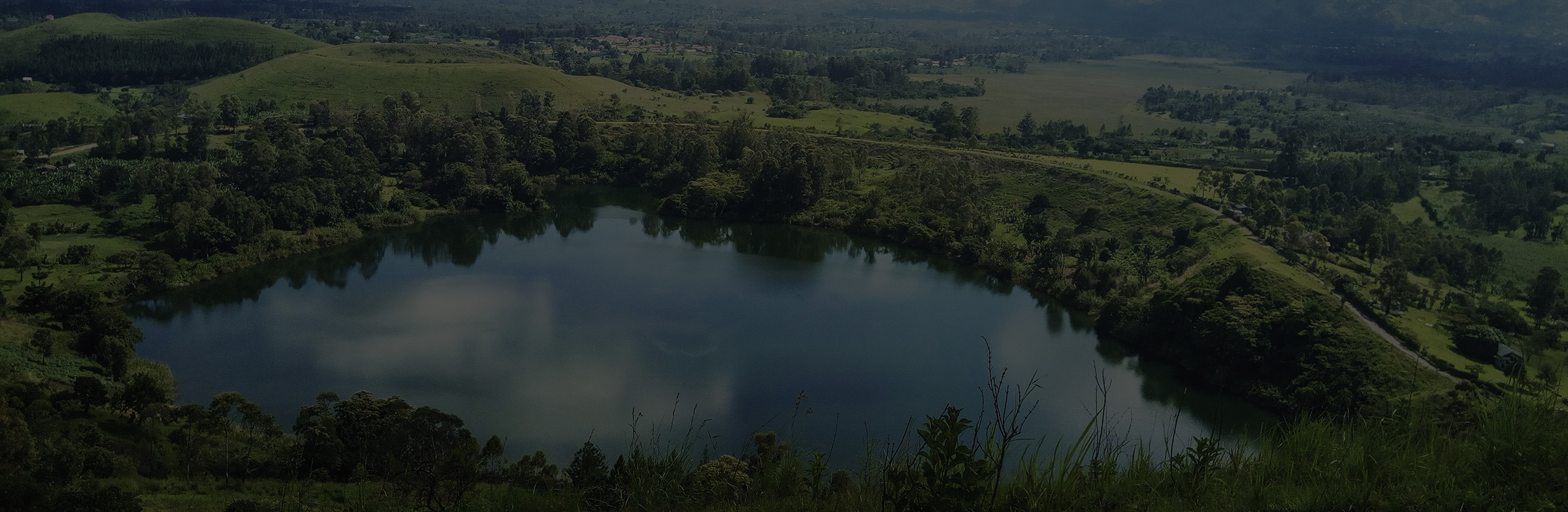
Rwenzori Mountain ranges are known to cover an area of about 996km2 the lowest point at the foot hill of the mountains stands at about 1,600meters while the highest peak Margherita raises to 5,109meters above sea level. Mountain Rwenzori is also known as “Mountains of the Moon”, the beauty of the mountains is escalated by the six peaks covered with snow and their way of undulating over a distance of about 120km. Rwenzori is block mountain and the third highest in Africa. Hiking is through the central circuit which can take you six day of ascent peak by peak covering one peak in a day. It is challenging and needs fit people physically; however a Rwenzori short circuit is available for the unfit people and families with children.
INQUIRE NOW
Departure
Kampala - Uganda
Departure Time
Please arrive by 9:15 AM for a prompt departure at 9:30 AM.
Return Time
Approximately 8:30 PM.
Dress Code
Casual. Comfortable athletic clothing, hiking shoes, hat, light jacket.
Include
5 Star Accommodation
Personal Guide
Airport Transfers
Breakfast
Not Included
Departure Taxes
Entry Fees
Day 1: Arrival
Arrive at Entebbe airport, Meet the driver guide for introductions and then transfer to Kampala. O/N Hotel Bougainviller or Pope Paul hotel or Hotel Africana (BB)
Day 2: Kampala – Kasese
After briefing, you will start the drive to Kasese stop over at the equator to take some photos after which you will get back on the road via Fort portal and pull off for Lunch. You will then drive to Kasese where you will make preparations for the hiking equipments and guide. The journey can last for about 7 hours. O/N: Margherita Hotel, Kasese (FB).
Day 3: Margherita hotel – Nyakalengija (1,646m) – Nyabitaba Hut (2,652m)
The day starts with a heavy breakfast then a drive to the park headquarters at Nyakalengija. Here you will receive briefing from the hiking guide and then get your equipment and porters then start the hiking at1, 646m through banana plantation belonging to Bakonjo homesteads at the foothills. In about 30 to 40 minutes you will cross the park boundary and then continue with the trail along River Mubuku and cross the landslide area, within 21/2 hours you will cross the Mahoma River after which you will meet steep slopes, open bluffs and Podocarpus forest before arriving at Nyabitaba. The hike can take up to 6hours. O/N: Nyabitaba Hut, 2,652m. (FB)
Day 4: Nyabitaba (2,652m) – John Matte Hut (3,410m)
Depart Nyabitaba hut and head westward on atrail for a half a kilometres and drop down northwards through a forest to Kurt Shafer Bridge. Continue out of the forest Nyamileju hut after which you will start the giant leather, lobelia and groundsel zone; the extraordinary vegetation types found only on high altitude tropical African Mountains. Proceed to John Matte for dinner and overnight, the journey can take up to 6 hours of hiking from Nyabitaba to John Matte. O/N: John Matte Hut – 3410m. (FB)
Day 5: John Matte (3,410m) – Bujuku Hut (3960m)
Depart John matte and start on a muddy trail across River Bujuku enters two Bigo Bogs and experience jumping from one tussock to another in a grassy bog. Continue to Bigo hut a favourable spot for those hiking mountain Stanley, the area is very cold. Then to Bujuku hut a whole journey taking about 51/2 hours. O/N: Bujuku Hut – 3960m (FB).
Day 6: Bujuku (3960m) – Elena Hut (4541m)
Continue the circuit west of Bujuku Hut on a trail rising and falling twice before ascending steeply through the magical Groundsel Gully towards Scott Elicot Pass (4,372m). As you continue with the trail branch off to the right and finally head to Elena Hut (4,372m). This is the base camp for climbing Margherita Peak (5,109m), and requires special hiking. O/N: Elena Hut (4541m) at the base of the Stanley Glacier, on a Full Board basis.
Day 7: Elena Hut (4541m) – Margherita peak (5109m) or Kitandara Hut (4023m)
This is a point where many take decided to continue to the peak with special hiking equipment while others start descending to Kitandara (4023m), due to fog, altitude sickness, climbing ability. For those ascending it can take up to three hours to reach at Margherita peak (5109m) and later descend to Kitandara Hut through Scott-Elliot pass, viewing the magical Mt Speke and Mt Stanley. O/N: Kitandara Hut – 4023m (FB)
Day 8: Kitandara (4023m) – Guy Yeoman Hut (3260m)
Start a journey of about 6hours with a sharp ascend to fresh field pass (4,282m), much heat is expected on the slope, so you are advised to start early. Continue with a flat traverse through gorgeous high alpine mossy and muddy glades. This is considered difficult due to the long muddy area. Carry on the descent through Bujangolo rock shelter, the base camp for the momentous mission in 1906 by the Duke of Abruzzi. O/N: Guy Yeoman Hut – 3260m (FB).
Day 9: Guy Yeoman (3260m) – Nyabitaba Hut (2652m)
Begin the decent very early in the morning down a muddy and very slippery trail paralleling and twice crossing the Mobuku River predominantly in deep mud to Nyabitaba. An overnight stop at the Hut for some rest is a necessary measure after the exhaustion of recent days.
O/N: Nyabitaba – 2652m (FB).
Day 10: Nyabitaba – Nyakalengija trailhead (1600m) – Kampala
You will end the hiking by a descent to park headquarters at Nyakalengija (1600m), from here you will continue back to Kampala via Kasese an approximate drive of 7 hours. Lunch en route. O/N: Hotel Bougainviller or Pope Paul hotel or Hotel Africana (HB)
Day 11: Departure
You will transfer to Entebbe airport for your flight back home.
RWENZORI MOUNTAIN ADVENTURE PRICES:Group Price EUR 1300, USD 1500, £ 1100 per person.
Single Room Supplement EUR 58, USD 76, £ 51
Virtuoso Africa SafarisPO Box 27903
Kampala, Uganda
Plot 3, Stensera Road, Off Nabunya Road, Ndeeba
Kampala City, UgandaTel: +256 414 272711
Mobile: +256 783 386181
Fax: +256 414 272761
virtuososafaris@gmail.com